The Beginning:

Source:http://www.storyvilledistrictnola.com
The Greater New Orleans area was settled on high ground between Lake Pontchartrain and the Mississippi River, with fill added to bring the city above average lake level, although still remaining below sea level. In 1927 Congress mandated that the Corps of Engineers was the federal agency to be responsible for the construction and design of the flood protection projects in Greater New Orleans. They also mandated that local government was to be responsible for the maintenance of the proposed levees.

Cross-section of New Orleans, showing the height of the levees at the Mississippi River on the left and Lake Pontchartrain on the Right. (Warner)
Construction:
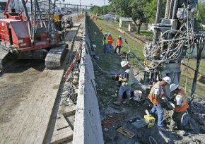
Source: nola.com
After flooding caused by Hurricane Betsy in 1965, congress initiated the Pontchartrain Hurricane Protection Project, which authorized the funds for maintenance and improvement of the levees. The levee system was then started around a much larger area than the city proper. The average elevation of the current city is between one and two feet below sea level, and the lowest residential area in the city is about ten feet below sea level. The project was faced with difficulties from the start, including design issues, environmental concerns, legal challenges, and opposition by those opposed to the project. The project was initially estimated to take thirteen years, but when Katrina struck in 2005, almost forty years later, the project was only 60–90% complete, and scheduled to be completed in 2015.
